The representative of the Spatial Data Fund of the Republic of Tatarstan spoke about the basic principles for creating chart maps when establishing or changing the boundaries of municipalities
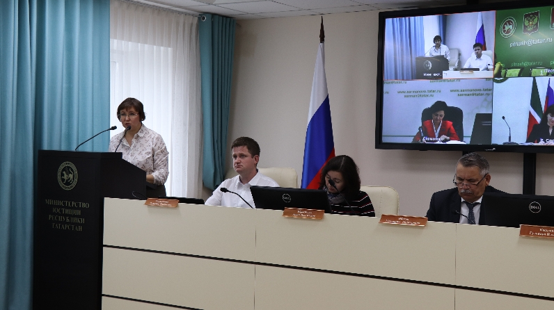
A seminar for representatives of local self-government bodies on the topic: “Territorial organization of local self-government”, which was held via video conferencing with the connection of all regions of the republic was held at the Ministry of Justice of the Republic of Tatarstan.
Changing the boundaries of municipalities is approved by the Law of the Republic of Tatarstan. For the draft Law, a schematic map that displays changes in borders and cartographic descriptions for all areas to be changed is required. The head of the department of geodesy and cartography of the Spatial Data Fund of the Republic of Tatarstan Vladimir Kandalintsev spoke about the basic principles of creating these maps.
The event was attended by Deputy Minister of Justice Mukharrym Ibyatov, head of the constitutional legislation department of the Legal Department of the State Council Office Liana Ibragimova, head of the geodesy and cartography department of the State Budgetary Institution “Spatial Data Fund of the Republic of Tatarstan” Vladimir Kandalintsev and head of the department for territorial organization and monitoring in the field of local self-government of Gulnara Kasymova.